NBRs use of drones: the machines are coming?
(Not the actual title…)
This is an English version of my 3rd contribution to Betorlaren (2018 #4), the Swedish sugar beet industry’s magazine. This was an early draft: the final Swedish version looks and reads better, thanks to the four helpful editors that fixed it up before it even went to the publishers.
In the last edition, we discussed how 5T benefits from using satellite images to gain a new perspective. This edition, we continue to discuss our eyes in the sky, but come back down to Earth to discuss drones.
A different way of seeing
Throughout the year, we observe our crops. We observe how the seeds are placed into the ground, how the crop emerges, develops, is attacked by pests, responds to treatment, yields, and proceeds through harvest. We all already complement what our eyes, and gut, observe with observations from machines (soil tests, temperature sensors, yield results, etc), and it seems certain that machine observations will only grow in importance. Unmanned Aerial Vehicles – UAVs or ‘drones’ – are one machine class that is rapidly gaining in popularity within agriculture and agricultural research, owing to their ability to provide a completely different angle to observe the living crop from. Drones are the tool in ‘high resolution remote imaging’, in that they provide images taken by a machine that a human is not in direct contact with, from a height of usually between 20 and 100 meters. Whereas the satellite images used in 5T have a spatial resolution of 10m, the drone can easily achieve less than 1 cm. The satellite can of course cover a much larger area and often more regularly, but for plot level research the higher resolution is required.
Researching remote imaging…
Research into the on-farm use of remote imaging is moving forward at a fast pace, with developments coming continuously. Once place NBR is researching in drone sourced remote imaging and contributing to this development is through a partnership with Nordic Sugar and Technological Institute in Denmark that began in 2017. This project pairs drone sourced multispectral images with human-sourced data on rates of fungal disease, with the aim of developing field-level methods for the detection of mildew, rust and ramularia. The first round of results have shown promise.
…and using remote imaging in research
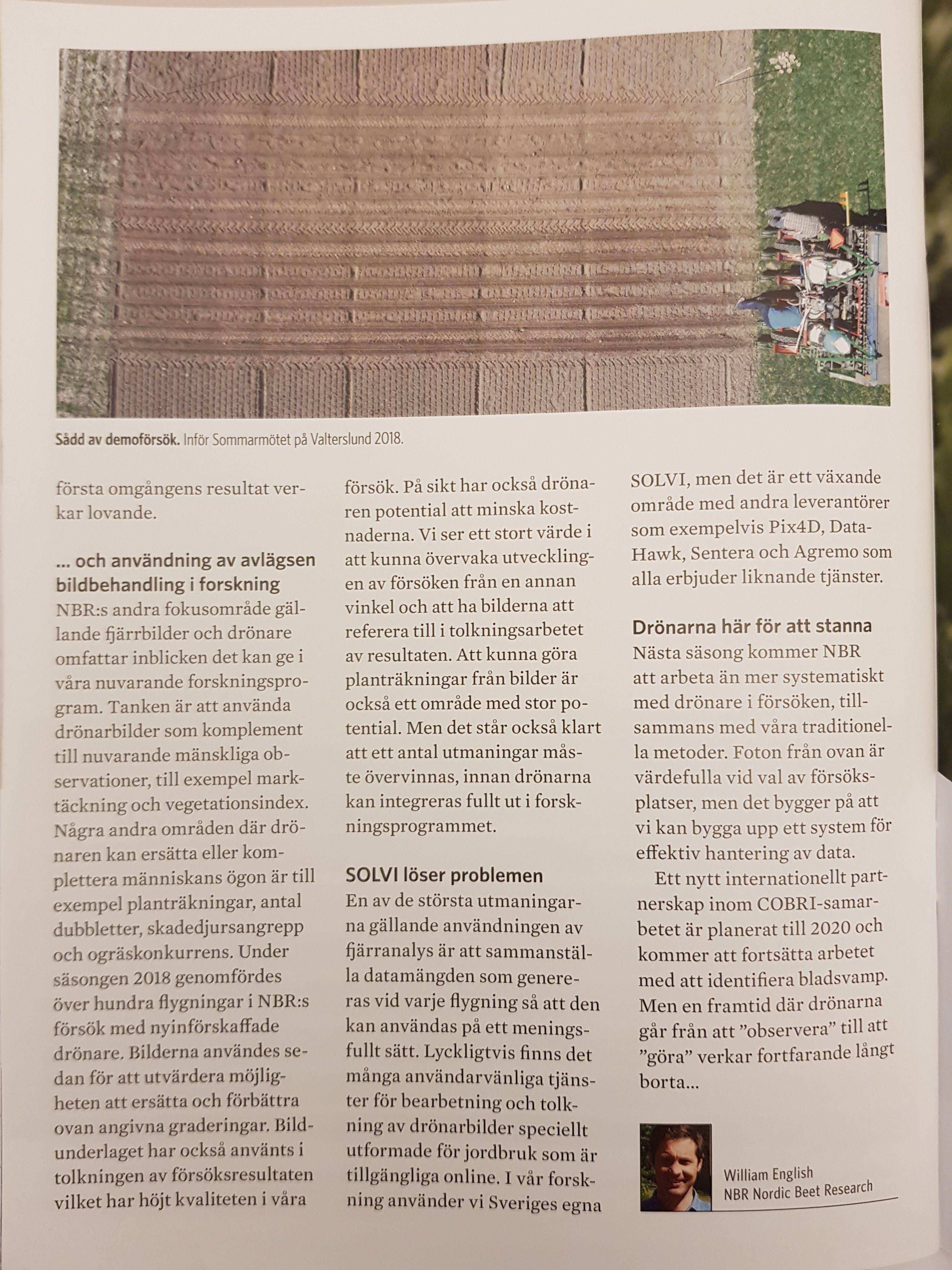
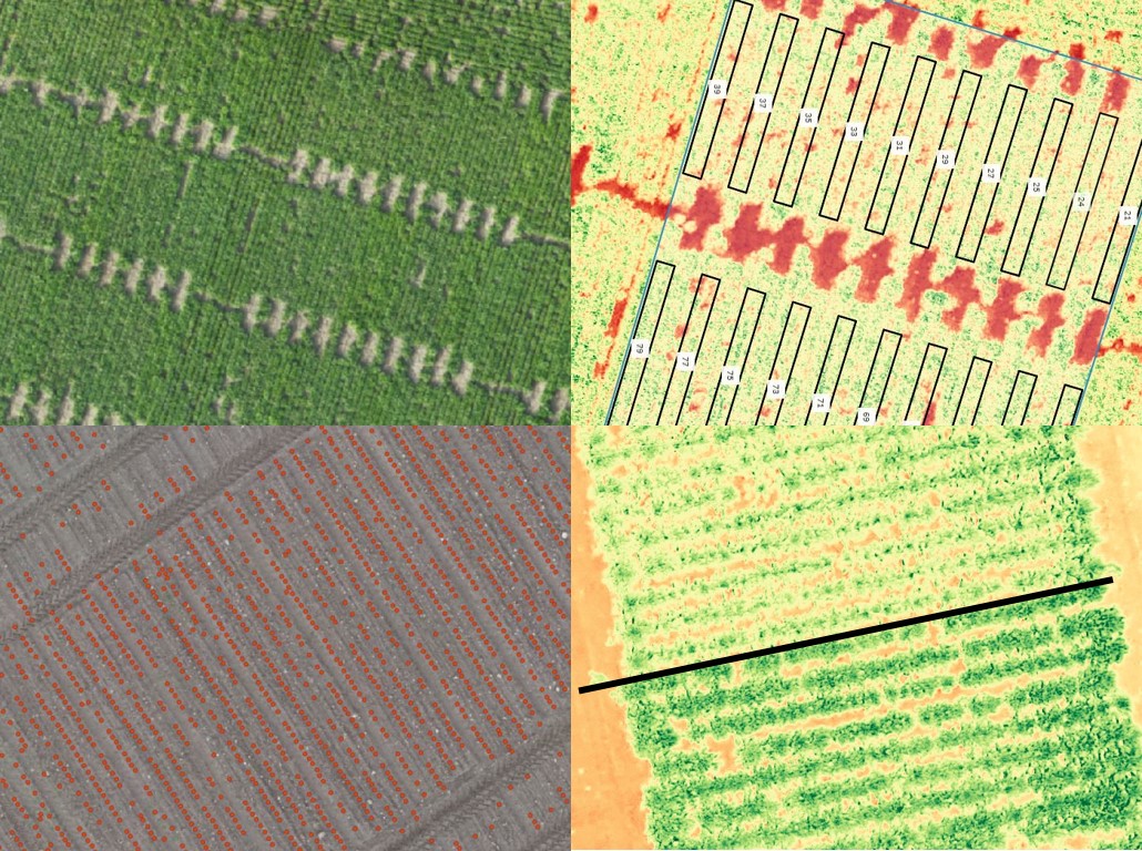
NBRs other focus with remote imaging and drones is integrating the insights it can provide into our current research program. Some observations, we can use as complements to current metrics, for example greenness and vegetation indexes. Some other observations have the potential to substitute current methodologies; plant counts, number of misses, number of doubles, severity of pest attack, and weed coverage. During the 2018 growing season, over 100 flights were undertaken as part of an ongoing internal review focusing on some of these opportunities. The review is focusing on how we can increase research quality with remote imaging, while also reducing cost. Great value was seen in simply being able to monitor the development of trials from a different angle and having the images to refer back to. Being able to conduct plant counts from images is also an area of great promise. It was also clear that a number of challenges must be overcome before the drones can be fully integrated into the research program.
One of the biggest challenges we face in using remote sensed images is compiling the masses of data we get with each flight so it can be used in a meaningful way. Fortunately, there are many user friendly services for processing and interpreting drone image specifically designed for agriculture and available online. In our research, we use Sweden’s own SOLVI, but it is a growing space, with other providers such as Pix4D, DataHawk, Sentera, and Agremo all offering similar services.
And beyond.
2019 will most likely see a more systematic use of drones in NBRs research program, alongside our trusted methods. A new international partnership within the COBRI collaboration is planned for 2020 which will continue the work in fungal identification. But a future in which the drones progress from ‘observing’ to ‘doing’, still seems a long way off…
The actual print version (click on them to see readable images):